Atlas
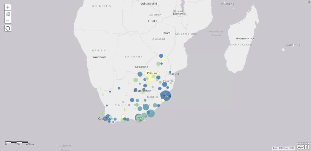
SOUTH AFRICAN AIR QUALITY (PM2.5) PREDICTIONS
Designed utilising JavaScript/HTML, this dataset contains daily estimates (2019-2020) of PM2.5 in 71 cities across South Africa.
Designed utilising JavaScript/HTML, this dataset contains daily estimates (2019-2020) of PM2.5 in 71 cities across South Africa.
This blog provides a comprehensive review of the available natural hazard tools and databases for disaster risk monitoring, mitigation, and analysis in South Africa. It aims to offer valuable insights into the current landscape of disaster risk management in South Africa.

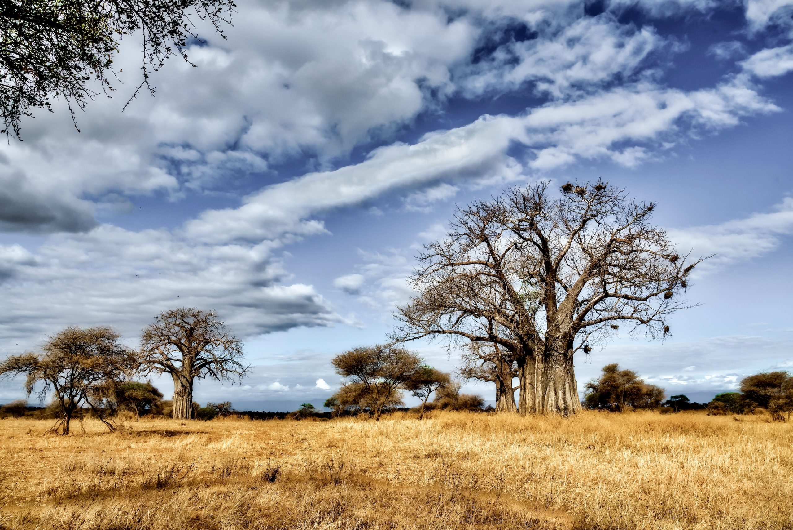
CLIMATOLOGICAL HAZARDS Back To All Risk Topics Contents Share this resource: Overview Natural hazards are precursors or catalysts for the onset of natural disasters, as highlighted by Chaudhary and Piracha in their 2021 research. These hazards act as the initial stages in a sequence that can ultimately lead to the development of significant natural disasters. The United Nations Statistical Division (UNSD) provides a comprehensive definition of climatological hazards, characterising them as meso- to macro-scale atmospheric processes encompassing a wide spectrum of temporal scales, ranging from intra-seasonal variations to multi-decadal climate variability. These atmospheric phenomena include events such as droughts, wildfires, glacial movement and glacial lake outburst. Droughts are periods of abnormally low precipitation or no precipitation compared to the average rainfall levels in an area. Droughts often lead to water shortages which have a detrimental impact on the environment, economy, society and agriculture. Droughts are also considered to be multifaceted natural hazards, given their variability duration, severity, and the geographical extent of their impact. Wildfires, also known as forest fires or veld fires, are highly destructive fires that burn uncontrollably and rapidly. Wildfires occur in natural vegetated environments, namely in forests and grasslands. These wildly burning fires (as is suggested by the name) are not easily put out or stopped and, therefore pose significant risks to both the environment and human communities. Wildfires occur within natural vegetated ecosystems, primarily in forested and grassland environments. These fires, aptly named for their uncontrolled and rapidly burning nature, can be caused by both natural factors and anthropogenic activities. Wildfires are remarkably challenging to extinguish or contain, these fires present substantial hazards, endangering both the natural environment and human communities. In the South African context, glacial movements and glacial lake outbursts hold no relevance, primarily due to South Africa’s geographical location as a subtropical region that lacks any glaciated terrain. Therefore, the focus of this blog will be directed towards wildfires. More information on droughts can be accessed here (LINK) South African Wildfire Records The Global Assessment Report (GAR) Risk Data Platform, has documented that South Africa records an annual average of 41 568 wildfires. The source, location and intensity of the wildfires are not listed on this platform. The GAR Risk Data Platform only provides data on the number of fires that have occurred within the country (Fig 2) as well as disaggregates it to the provincial level (Fig 2). The wildfire events are grouped based on the presence or absence of protected areas in a region as delineated in the World Database on Protected Areas (WDPA), as well as within forested regions. The fire data on the platform is derived from the MODIS Collection 6 Active Fire Product MCD14ML. The records presented on the platform includes both annual fire data, cumulatively compiled from monthly fire records, as well as data specifically pertaining to fires occurring in critical regions such as forests, protected areas designated in the World Database on Protected Areas (WDPA), and forests located within protected areas. The fire records contained within this dataset are not restricted to wildfires (vegetation fires). Instead, they include fires associated with active volcanoes, other static land sources, and offshore fires. This variation in recorded fire events accounts for the notably high volume of fire data available on the platform. Knysna Fire On the 7th of June 2017, the country witnessed the ignition of one of the most significant fire hazards in recent history: the Knysna Fires in the Western Cape. Over the course of their 11-day duration, these fires consumed more than 100 kilometres of land. The cause of the fires was primarily attributed to natural factors (drought like conditions, high temperatures and strong Berg winds) and were exacerbated by environmental conditions such as dry vegetation, strong winds, low soil moisture levels, and elevated temperatures. These factors collectively contributed to the development of smaller fires (which eventually merged into one big fire) as well as to the rapid and uncontrollable spread of the fires. As the fires swept through the Greater Knysna areas, they left a trail of devastation in their wake. The profound impacts of the fire encompassed loss of life, extensive destruction of homes, the displacement of residents, and the widespread scorching of vegetation. Impact of the Knysna Fire: Loss of Life: Tragically, the fires resulted in the deaths of 9 people (EM-DAT). Property Damage: The fires caused extensive damage to residential properties, businesses, and infrastructure. Approximately 1200 homes were destroyed in the fires. Environmental Damage: The ecological impact of the fires was great as the fires scorched more than 20 000 hectares of vegetation as well as destroying natural habitats and wildlife. Community Disruption: Thousands of residents (approximately 5500) were forced to evacuate their homes due to the advancing fires. Emergency shelters were established to provide temporary housing and support for those displaced. Economic Damage: EM-DAT’s estimation indicates that the economic losses due to structural and environmental damage from the fires exceed a sum of $500,000. Databases FIRMS GAR Risk Data Platform CAELUM Database EM-DAT First Record: 11 Nov 2000 First Record: Jan 2003 First Record: 2 Oct 1989 First Record: 7 Sep 1991 Data Formats: SHP, KML, TXT, WMS Data Formats: XLS, TXT Data Formats: XLS, TXT Data Formats: XLS, TXT, PDF, JPEG Total number of recorded fires: ~40 000 annually Total number of recorded fires: ~40 000 annually Total number of recorded fires: 472 Total number of recorded fires: 10 The FIRMS and GAR Risk Data Platform databases have the highest number of fire records, primarily relying on imagery generated by the Moderate Resolution Imaging Spectroradiometer (MODIS) satellite. This satellite provides high temporal and spatial resolutions, allowing for a revisit to specific sites every one to two days. This capability enables the real-time and near real-time cataloging of fires. However, these records include not only wildfires but also offshore fires, fires associated with volcanic activity, and static land source fires. Therefore, these supplementary sources of fire data contribute to the overestimation of the total number of reported fires by these sites.
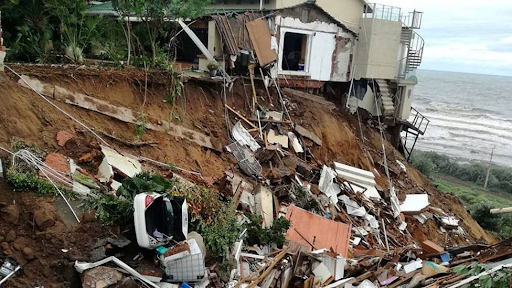
GEOPHYSICAL HAZARDS Back To All Risk Topics Contents Share this resource: Overview Geophysical hazards stem from inherent geophysical processes within the Earth, encompassing phenomena such as tectonic activity, volcanic eruptions, and seismic events. These processes give rise to catastrophic events, including but not limited to earthquakes, volcanic eruptions, landslides, and sinkholes, among others. The occurrence of these hazards possesses the potential to cause substantial adverse ramifications upon human populations, infrastructure, and the environment. It is important to note that while these events are classified as geophysical disasters, they are often interconnected with other natural and human-induced factors. Consequently, these geophysical hazards don’t always occur in isolation; they can intertwine with one another or with other factors caused by humans. This interaction can lead to a situation where these hazards happen alone or in conjunction with other hazards, making the overall effects they produce more substantial. This pertains not only to how extensive the impact is spread but also to the scale of the effects, how intense they are, and how long they persist. In essence, these hazards can become more formidable when they join forces with other factors, magnifying the challenges they pose. Geophysical Disasters Earthquakes As per the definition provided by the United States Geological Survey (USGS), an earthquake is characterised as a sudden slip along a fault line, leading to ground shaking and the release of seismic energy (USGS, no date). The measurement of earthquakes is typically conducted using the Richter scale. The most significant magnitude registered within the last decade was recorded in Orkney City (North West Province) on the 14th of August 2014, specifically 5.4 magnitudes, as reported by https://earthquakelist.org/and confirmed by EM-Dat data accessible through https://public.emdat.be/ Landslides/Mudslide Landslides are the downslope displacement of various materials, such as soil, rock, and organic substances, driven by the gravitational forces when they surpass the frictional resistance of the material resisting the slope (Varnes, 1978). In South Africa, mudslides and landslides frequently occur as a result of heavy rainfall and flooding events. Therefore, subsequent to the extensive flooding experienced in the KwaZulu-Natal Province in April 2022, NASA meticulously and manually mapped the locations of 91 landslides that occurred as a result of the flooding in KwaZulu-Natal (NASA, 2022). Volcanic Activity A volcano is formally defined as a rupture in the Earth’s crust through which hot lava, volcanic ash, and gases are emitted (). The process by which these materials are expelled from the Earth’s interior is referred to as a volcanic eruption, which can vary in terms of intensity (). It is important to note that there are no documented records of volcanic activity within the geographical boundaries of South Africa. However, on the 4th of June 2011, a significant event occurred when a cloud of volcanic ash resulting from an eruption in the Andes region remained suspended over the Cape Town area for an extended period, persisting for approximately nine days (SAWS, 2017). Earthquakes in South Africa On the 11th of June 2023, an earth tremor with a magnitude of 4.9 was recorded in Alberton, which is located to the south of Johannesburg. This seismic event was followed by additional tremors within the Gauteng province, occurring on June 27th and July 22nd, both registering a magnitude of 4.2 on the Richter scale. Within the geographical context of South Africa, occurrences of landslides, mudslides, and volcanic activities are relatively rare. Therefore, the primary focus of the geophysical hazards in this communication is centered on the occurrences of earthquakes. Two distinct sources have been identified as valuable repositories of seismic data for South Africa. A brief overview of the information and data obtained from these sources is presented below for your reference. Data Sources Additional information pertaining to the likelihood of the occurence of fires occurrences of geophysical hazards, specifically earthquakes, can further be investigated and explored through the links and sites listed below. Data Source Link Supplementary Information EM-Dat https://public.emdat.be/data Occurrence of natural disasters which either impacted at least 100 people, caused the death of at least 10 people, an official state of disaster was declared or an appeal for international humanitarian assistance was made. Earthquake List Earthquakelist.org This database provides an overview of the latest earthquakes in South Africa. This database is updated every minute and includes all seismic activity (minor and major) reported and recorded in South Africa.
Compiled utilising information from the 2018 National Biodiversity Assessment (NBA) by the South African National Biodiversity Institute (SANBI), this blog speaks to the current status and protection level of South Africa’s terrestrial ecosystems.

4th October 2022 – The South African Risk and Vulnerability Atlas (SARVA) hosted a half-day Python Workshop. Click the link below to get access to the notebooks, slides, and full workshop recording.
4th May 2022 – The South African Environmental Observation Network SARVA (South African Risk and Vulnerability Atlas) team in conjunction with the Sol Plaatje University Risk and Vulnerability Science Centre (RVSC) hosted a half-day workshop on GIS and Risk Analysis.
Compiled utilising information from the 2018 National Biodiversity Assessment (NBA) by the South African National Biodiversity Institute (SANBI), this blog speaks to the current status and protection level of South Africa’s marine ecosystems.