SARVA 3.2
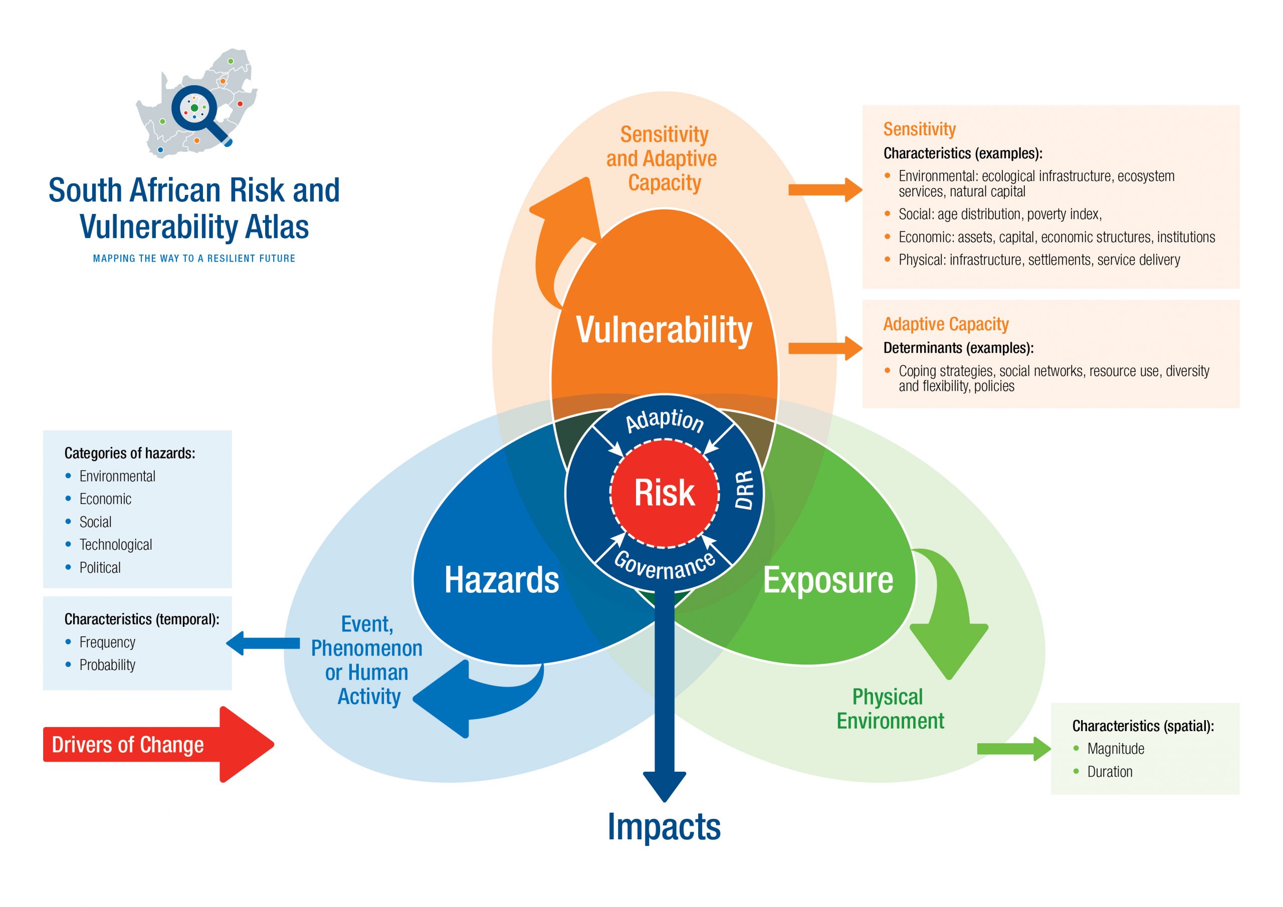
SARVA is an initiative of the Department of Science, Technology and Innovation (DSTI) and forms part of a 10-year Global Change Grand Challenge. It is currently in its third phase of implementation, focusing on improved access to ecological, economic, human, and settlement data and the development of decision-support tools that assist with evaluating and managing the risks associated with global change.